Skip to main content
City of Burbank, CA
BPL Home
Menu
Search
Browse Collections
Burbank History
Burbank History
Timeline
Resources
Podcast
About Us
About Us
Frequently Asked Questions
Collection Development Policy
Contact Us
Search
You are here
Home
Browse Collections
Around Burbank: Businesses, Homes, and Streets
Maps
Maps
Maps of Burbank and surrounding area.
Grid view
List view
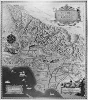
1800s - Map of the old Spanish and Mexican Ranchos of Los Angeles County
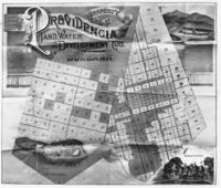
1887 - Providencia Land and Water and Development Company's Parcel Map of Burbank
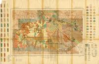
1915 - San Fernando Valley Soil Map
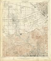
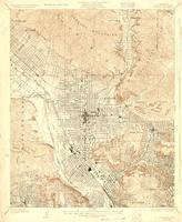
1926 - Burbank Quadrangle Topographic Map
1928 - Glendale Quadrangle Topographic Map
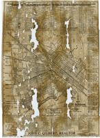
1932 - City of Burbank Map
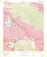
1972 - Burbank Quadrangle Topographic Map